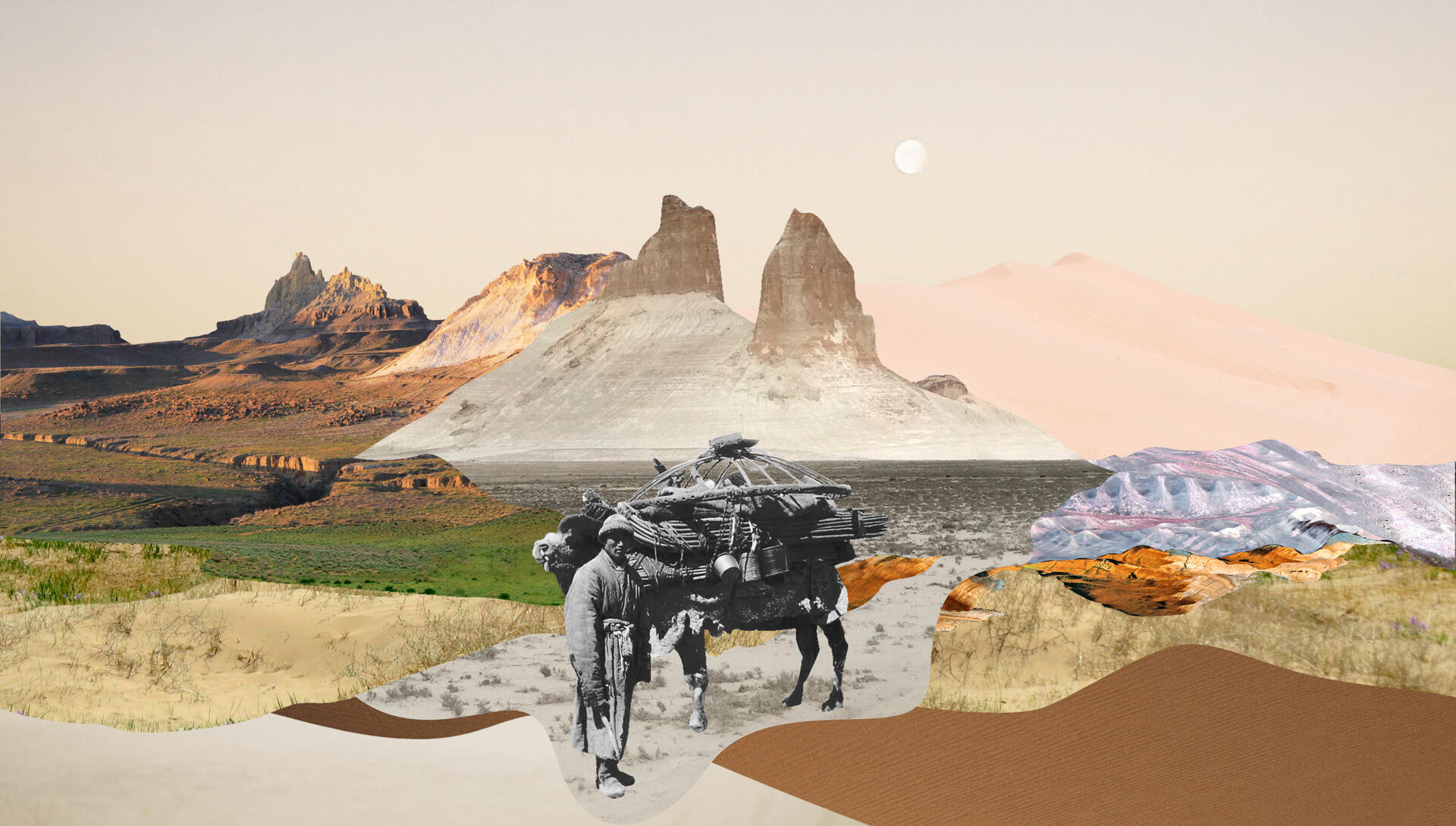
In the beginning of November, thanks to travelers and environmental activists, the general public of Kazakhstan learned of the threat posed by hotel construction at the Bozjyra site in Mangystau. Environmental activists and experts claimed that the construction proposals for Bozjyra contained numerous violations and warned of potentially irreparable damage to the local ecology and terrain.
A number of Kazakhstani and foreign experts have spoken out about the touristic, economic, natural, and environmental risks for the unique site. At Adamdar/CA’s request, Zira Naurzbayeva told us about Bozjyra’s cultural uniqueness and sacred nature.
Zira Naurzbayeva is a cultural scientist, writer, one of the leading researchers of Kazakh mythology, a Ph.D. candidate, and the author of The Eternal Sky of the Kazakhs, Four Clouds, and other books.
It’s surprising, but in mythologist, historian, and linguist Serikbol Kondybay’s (1968-2004) collection on the toponyms of Mangystau, containing hundreds of names, Bozjyra is nowhere to be found. Serikbol, a geographer in his first profession, wrote his thesis, “The Aesthetic of Mangystau’s Landscapes: Prospects for Tourism Development,” in 1991. It also contains a few studies of his native region, yet Bozjyra did not attract his attention. I interviewed several Mangystau experts, who also were not able to tell me anything substantial about the site, besides the fact that there were once many aran (traps for driven hunts) here.
At first, the lack of attention to Bozjyra among Mangystau Kazakhs discouraged me, and then it gave me pause. The name Bozjyra itself emphasizes not the cliffs (the steep edges of the Ustyurt Plateau), and not on the bizarrely shaped buttes. The word zhyra—“pothole, gully, ravine”—refers to the geological processes that formed this valley. Boz—“light gray, whitish, ash gray”—can also mean “feather grass” or “salt flat.” The definition of boz contains the connotation of “twilight, the middle ground between two states.” For example, bozbala, “teenager, unmarried youth”; or bozalang, “grayish, pale, dim” (as in pre-dawn). Bozjyra is the name of a valley, a canyon between the cliffs and the buttes, the middle ground between them.

Why is the emphasis placed on the valley? Perhaps because the bizarre-looking buttes were unsuitable for grazing or nomad camps? Or is there some kind of aesthetic principle at play that differs from modern ones? Ruminating on this, I remembered how Kondybay interprets one of the historical legends about the Kazakh return to Mangystau in the 18th century:
“The Kazakhs, moving around Ustyurt, approached the descent at Karatyuye, Man-ata. Stopping at the edge of the plateau, they looked at the lowland spread out below. In the distance, the spurs of the mountain Otpan rose over the dusty haze. One of the heroes, glancing at the faraway mountain, said to his fellow traveler, “Come down from your horse and give me two handfuls of earth.” His comrade fulfilled this request. The hero tossed the earth up into the air, threw his black chapan from his shoulders, and ordered his companions to jump down. They descended to the plain on the road near Man-ata. Later, one of the warriors asked the hero about the meaning behind his actions. He explained: “I noticed Turkmen sentries on the peak of Mount Otpan. They probably noticed us as well. Therefore, I threw two handfuls of dust and dropped my black chapan, so that they would take this blurry scene in the distance for a golden eagle taking off.”
Serikbol notes that the story is far from realistic; around 100 kilometers separate Man-ata from Otpan, the sentry mountain. However, analyzing the similar plot of the epic “Yedige,” he arrived at the following conclusion: “In the legend about the Kazakhs’ arrival to Mangystau, one can see the mythological motif of ‘traveling to the underworld’ because one of the functions of the karakus (“black bird”), is the guardian of the otherworld.” For Kazakhs, Mangystau seemed like a “magical world,” and the arrival of the Aday people to Mangystau (the descent from the plateau to the lowlands) was identified with the “journey to the otherworld.” This other, lower world is the world of deceased ancestors.
The name of the Ustyurt Plateau contains the root ust, “top, surface, front side.” Kazakhs have also called it kyr, “highland, raised place, edge, verge.” The slopes from Ustyurt down to the valley are called kulama, from the verb kulau, “to fall, to rush down.” Zhygylgan, “fallen, ruined,” is not only the name of a cape on the Caspian sea; there is also a valley here with this name. One of the common components of local toponyms is oy, “lowland, depression, hollow,” related to the verb oyu, “to cut.” Local residents often call their region tubek, “peninsula.” The root of the word tubek, tup, means “bottom, root, base, root cause,” and so on. On the one hand, all of these names express geographic particularities; on the other, they emphasize the Mangystau’s mythological image as the underworld. This is the eternal opposition of top and bottom, the summer nomad camps of Ustyurt and the winter residence of Mangystau.
Bozjyra as the border between plateau and lowlands is one piece of the Mangystau mosaic. Nowadays, we pay attention to the buttes, whereas our ancestors looked to the valley. Is this difference of perspective—up versus down—due to the fact that now, we approach Bozjyra from below, while our ancestors first saw this area from above, from the plateau? Or is there something more to this difference? The situation is reminiscent of a picture in which you can see either a young girl in a fur coat or an old woman in a bonnet. Or Kazakh ornaments, whose pattern and background are identical, equal, and interlocking.
Another concept important to Mangystau is shynyrau. Shynyrau is an ancient, ambivalent Kazakh word, signifying at once the vault of the heavens and the earthly abyss, as well as being another name for the bird, called Samurk or Alyp Karakus, which flies between three worlds: heavenly, earthly, and underworldly. This is also what the 60-90 meter-deep—sometimes even deeper—wells are called in Mangystau, without which life in these regions would have been impossible (Abish Kekilbayev has a story of the same name dedicated to one of the great well-diggers who perished while working). The vertically structured mythological model of the region is reflected in this concept.
Mangystau is called the land of 362 saints. Many of the saints, according to legend, were disciples of Khoja Ahmed Yasawi who headed westward from Turkestan to preach Islam on their teacher’s instructions. The other explanation is that religious people nearing the end of their lives would set off on a pilgrimage to Mecca, wishing to be buried there. But during their difficult treks across desolate lands, they would die at the southwesternmost point of Kazakh soil when their path ran into the sea. From a mythological perspective, the west and the sea, once again, represent the otherworld, the world of the dead. Considering the ancestor cult among the Kazakhs, this is sacred land.
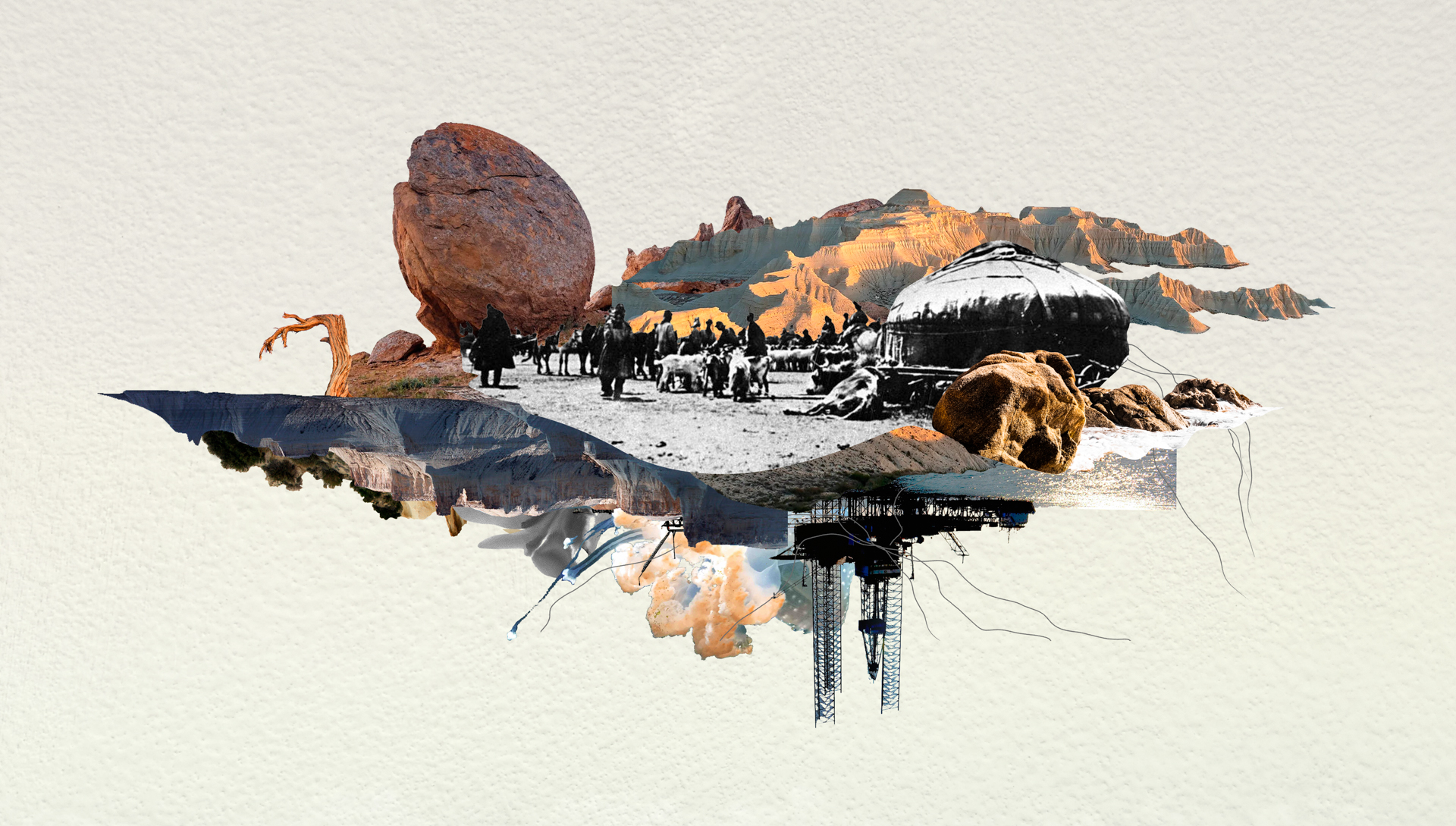
Immediately after his death, people began to call the scholar Serikbol Kondybay the 363rd saint of Mangystau. In the book Mangystaunama, he writes about how the peninsula’s image changed during different periods of history, and how in the 1960s-70s specialists from all corners of the USSR came here to extract minerals and construct a nuclear plant. For the new arrivals, this was “unclaimed, wild country, full of romance and exoticism.” They had no interest whatsoever in the history and culture of the indigenous people. “Mangystau was called ‘the land of a thousand roads’; the roads that crossed the steppe in all directions became, for them, a symbol of renewal and progress. But, of course, they did not notice that, along with the soil and grass their cars’ tires crushed, along with the dust flying from beneath the wheels, they were also scattering to the winds the true nature and history (however dilapidated) of this region.”
This image is very accurate. I was not at Bozjyra, but at Sherkala and other buttes, I noticed that the type of rock of which they consist crumbles even under my sneakers and my light weight. It is much looser than, for example, at Charyn Canyon, although both the Mangystau buttes and Charyn formed the bed of the Tethys Ocean. This is why we must not only be very careful with construction in these places, but in some way limit travel by car and even the number of tourists wishing to climb these especially fantastical buttes. The indigenous people, who have preserved a spiritual connection with their native land, are seriously disturbed not only by the erosion of the soil, but also of the threatened desecration of the peninsula’s spiritual and natural monuments.
Other materials on this topic:
Saving Bozjyra— interview with Azhar Jandosova